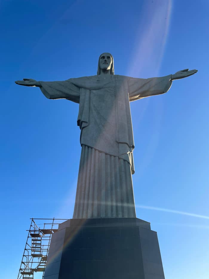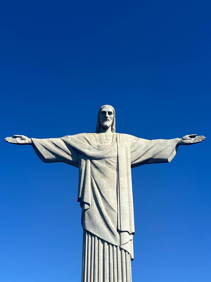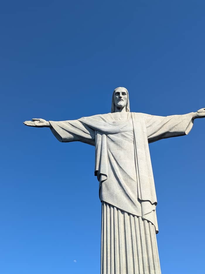
Up close
The platform
At its feet
- Height38 m with pedestal23
- AccessTrain, van or trail
- Best forThe city panorama
Your stop on the map
Browse 15 stops
Tap a route first, then a pin or stop, for its note and Google Maps.
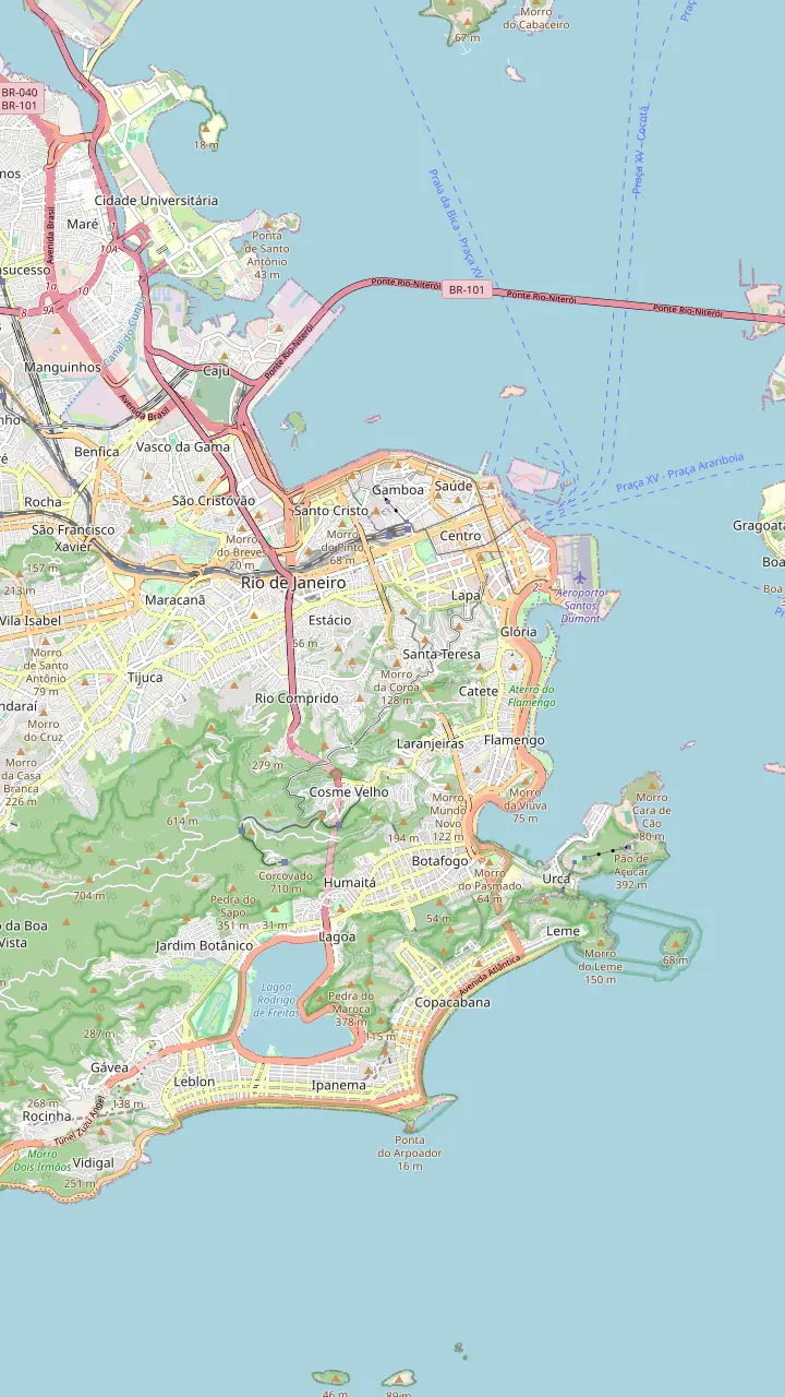
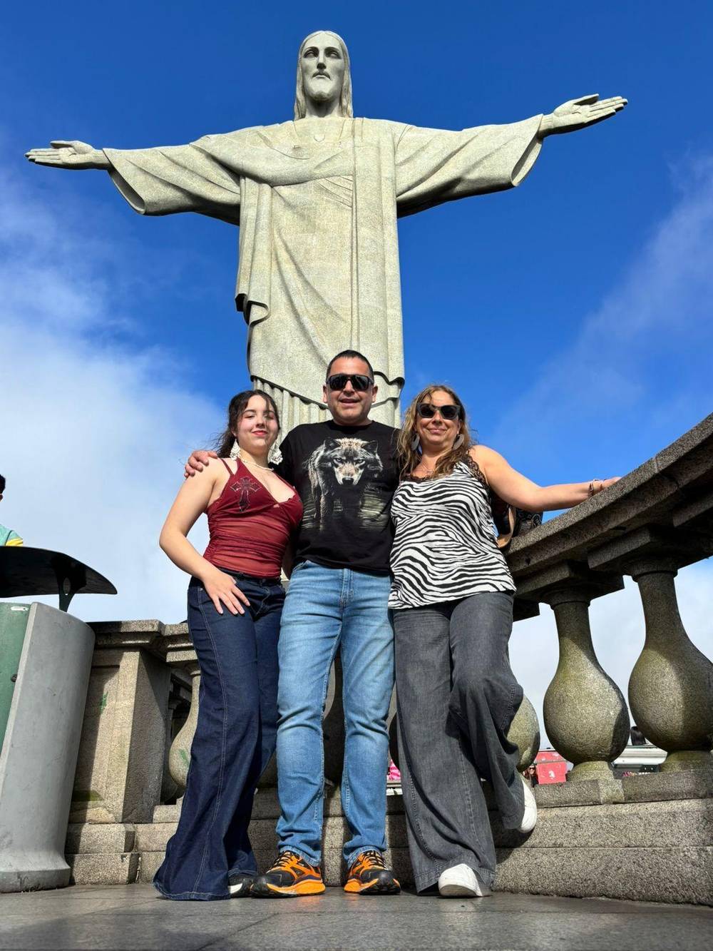
The statue and its platform: 38 metres of statue and pedestal on a rock mountain the park gives as 704 metres high.
Google MapsThe granite peak by the bay entrance, once one of the candidate sites for the monument.
Google MapsThe lagoon below the statue, one of the landmarks you pick out from the platform.
Google MapsThe stadium on the north side, visible from the top of Corcovado.
Google MapsThe bridge that carries the road across Guanabara Bay to Niterói, seen from the top.
Google MapsThe long curve of beach you see beyond the lagoon and the hills.
Google MapsThe beach west of Copacabana, easy to spot from the platform.
Google MapsA lookout at 360 metres that frames Sugarloaf, the Maracanã, the bay and Corcovado in one view.
Google MapsThe old Paineiras hotel, opened in 1884, now a visitor centre and a boarding point for the official vans.
Google Maps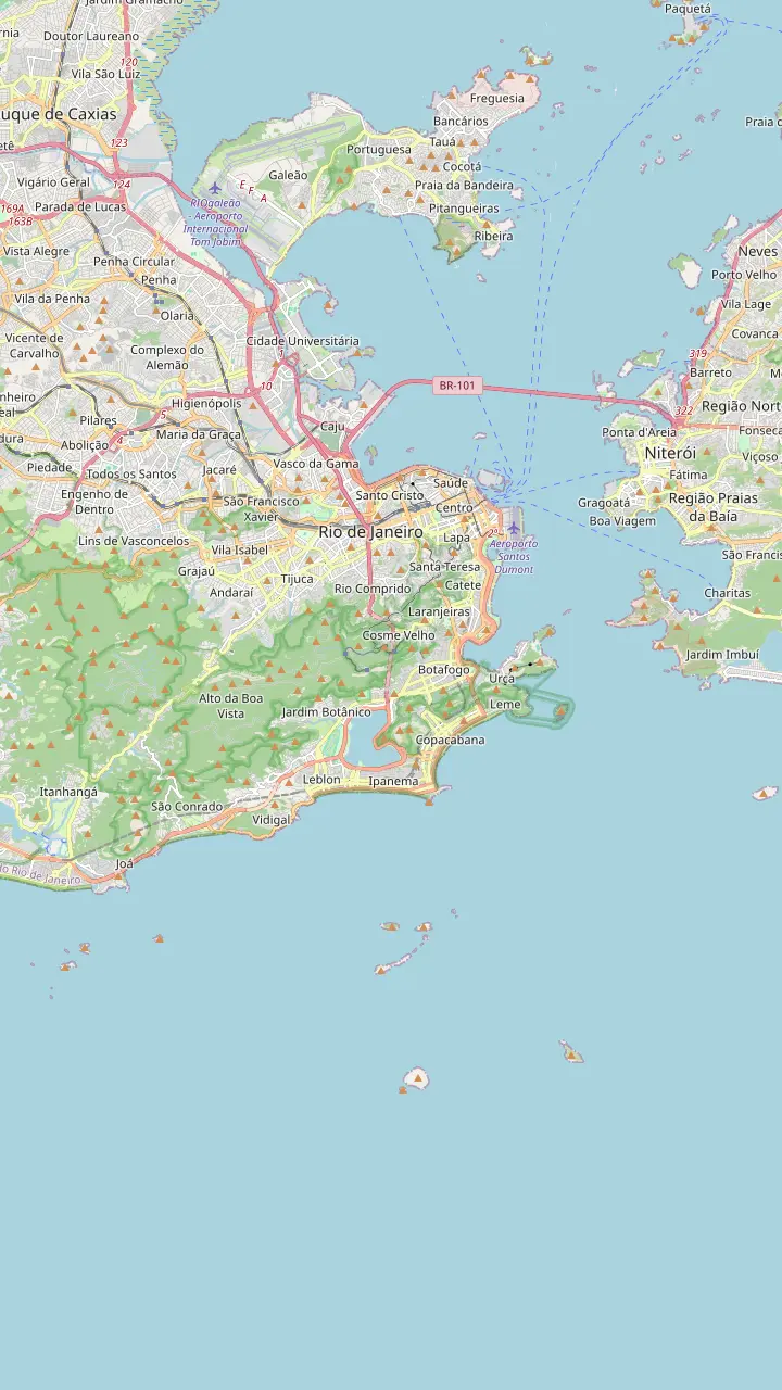
The statue and its platform: 38 metres of statue and pedestal on a rock mountain the park gives as 704 metres high.
Google MapsA lookout at 360 metres that frames Sugarloaf, the Maracanã, the bay and Corcovado in one view.
Google MapsA pagoda-style lookout built between 1902 and 1906, facing the south zone and the lagoon.
Google MapsThe granite peak by the bay entrance, once one of the candidate sites for the monument.
Google MapsThe lagoon below the statue, one of the landmarks you pick out from the platform.
Google MapsThe old Paineiras hotel, opened in 1884, now a visitor centre and a boarding point for the official vans.
Google Maps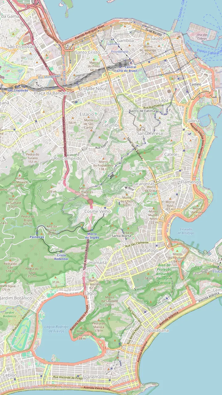
The statue and its platform: 38 metres of statue and pedestal on a rock mountain the park gives as 704 metres high.
Google MapsRua Cosme Velho 513, where the Corcovado Train starts its climb through the forest.
Google MapsThe old Paineiras hotel, opened in 1884, now a visitor centre and a boarding point for the official vans.
Google MapsAn official van stop facing the Glória parish church, a short walk from the metro.
Google MapsCopacabana's official van stop, by Posto 2 of the beach.
Google MapsThe newest official van boarding point, in the cathedral car park in the centre.
Google MapsThe Parque Lage gate on Rua Jardim Botânico, where the steep forest trail to Corcovado begins.
Google MapsMap data: © OpenStreetMap contributors
Where is the Christ the Redeemer statue? On the summit of Corcovado, a forested rock peak inside Tijuca National Park, rising straight out of Rio's south zone.
Editorial team, christtheredeemertour.top · Updated November 11, 2026 · Read in 7 min
Key facts
Where is the Christ the Redeemer statue, exactly? It stands on the very top of Corcovado, a bare rock mountain that Tijuca National Park gives as 704 m high.1 The railway that climbs it gives the summit as 710 m,7 so you will see both figures in official material. Either way, the statue sits far above the rooftops, on the ridge that separates the beach districts from the rest of the city.
The peak belongs to the Serra da Carioca, one of the park's visiting sectors, which also holds the Paineiras road and the lookouts below the summit.2 The sanctuary itself describes the monument as set in the Atlantic Forest of Tijuca National Park,8 and that is what you notice on the way up: dense green slopes, birdsong and damp air, then suddenly open sky and the whole city at your feet.
Christ the Redeemer in Rio de Janeiro has a double status. The forest, the roads and the summit complex are national park land, while the platform, the chapel and the structure of the statue belong to the Catholic Church through the Archdiocese of Rio.9 That is why you meet park wardens and sanctuary staff side by side at the top, and why the rules come from both of them.
From the platform
| Landmark | Where to look | What it is |
|---|---|---|
| Guanabara Bay | To your left | The bay and its islands5 |
| Sugarloaf | Over the bay | Granite peak with a cable car5 |
| Copacabana & Ipanema | Toward the ocean | The great beaches6 |
| Rodrigo de Freitas | Below, in the valley | The city's lagoon19 |
| Maracanã | The north side | Rio's famous stadium20 |
| Rio-Niterói Bridge | Across the bay | Road link to Niterói21 |
| Tijuca Forest | All around you | The national park22 |
Directions follow the official van concession's guide to the view from the statue.5,6
Is Christ the Redeemer on Sugarloaf Mountain? No. Sugarloaf is the separate granite dome at the mouth of Guanabara Bay, reached by cable car, while the statue crowns Corcovado further inland. The mix-up is easy to understand, because the peaks share almost every postcard of Rio and each looks across at the other.
The confusion even has a historical root. When the Catholic Circle met to choose a site for the monument ahead of the centenary of independence, the shortlist was Morro de Santo Antônio, Sugarloaf and Corcovado.4 Corcovado won, and the sanctuary links that choice to an old dream of the French priest Pierre-Marie Boss, who had imagined a statue of Christ on this summit years before.16
Today the relationship is reversed: Sugarloaf is one of the best things you see from the statue. Standing on the platform with the statue at your back, the bay and its islands spread out to your left, with Sugarloaf and its cable car rising from the water.5 If you plan to visit both peaks on one trip, our page on whether the statue is worth it compares the two as experiences.
The platform sits on the summit like a balcony, and the official van concession has mapped what to look for. Guanabara Bay and its islands lie to your left, with Sugarloaf standing out above them.5 Ahead and slightly right, the long sweeps of Copacabana and Ipanema are easy to pick out,6 separated by rocky headlands and rows of apartment towers.
Closer in, the Rodrigo de Freitas lagoon fills the valley below with its odd, rounded shape, one of the landmarks that helps you read the map of the city.19 Turn the other way and the Maracanã stadium shows on the north side,20 while the bridge to Niterói crosses the bay in a thin grey line.21 Behind and around you, the Tijuca Forest rolls off toward the horizon.22
A history of the monument published by the São Paulo state legislature notes that, from its summit, the statue commands an arc of about 276 degrees, visible from the sea, the center and many suburbs.26 In practice that means almost every district can see the statue, and the statue sees almost every district back. On a hazy morning you may only make out the nearest hills, so read our best time page before you choose your slot.
Plan your view
Pick the view you are after.
If I want the whole city below me
The summit platform
Bay, Sugarloaf, beaches and lagoon from a single balcony.5,6
If I want the statue in my photo
Dona Marta lookout
It frames Corcovado and Sugarloaf together.17
If I want a forest walk with a view
The Paineiras trail lookout
A glass lookout at about 600 m.18
If I want to see the sun rise first
A sunrise lookout tour
Dona Marta at dawn, then the statue.
If I want it explained by a guide
A guided Christ and Tijuca day
7 hours with pickup included.
Ways to see it
Corcovado takes its name from corcova, a Portuguese word for a hump, and the bent profile of the peak makes the choice easy to understand once you see it from the bay.39 Its first officially recorded ascent dates from 22 February 1824, an honor that fell to Emperor Pedro I.10 For decades after that the climb remained an adventure for the few, on rough paths through the forest.
The park stresses that Corcovado was already an important viewpoint for the city long before any statue stood here.40 The railway that still carries visitors opened in 1884, almost 50 years before the monument was finished,12 and the same year Pedro II opened the hotel at Paineiras, halfway up the slope, which now serves as a visitor center.28,29
So when the builders arrived, they were adding a monument to a place people already loved for its view. The train even became part of the construction story, hauling materials up the mountain,41 and it is still the classic way up today. If you take it, watch the forest thin out near the top: that is the moment the city opens below you.
Go up and see it
Compare ways to reach the statue.
Compare 3 choices
Compare ways to reach the statue.
≈
View≈
View≈
ViewConverted at the ECB reference rate, from-prices as listed by GetYourGuide. The precise amount is shown when you book.
Corcovado through time
1824
An imperial party reaches the summit.10
1861
Tijuca and Paineiras declared protective forests.11
1884
The line up the mountain starts running.12
1931
Christ the Redeemer inaugurated on 12 October.13
1961
The Tijuca massif becomes a national park.14
1967
The park takes its current name.15
The green blanket around the statue is not untouched jungle but one of the world's great replanting stories. In 1861 Emperor Pedro II declared the forests of Tijuca and Paineiras protected and ordered them restored.11 In only 13 years, more than 100,000 trees were planted, most of them Atlantic Forest species.42
In 1961 most of the Tijuca massif, Corcovado and Paineiras included, became a national park, first called the National Park of Rio de Janeiro,14 and on 8 February 1967 it took the name Tijuca National Park.15 It is now heavily used: in 2024 it was again the most visited national park in Brazil, with more than 4.6 million visitors.43
The rock under your feet is far older than any of that. The park describes its mountains as built of rocks around 1.7 billion years old,44 mostly gneiss, a metamorphic rock.45 Look at the bare grey cliffs below the platform: that is the ancient stone the whole summit is made of, streaked dark where water runs off after rain and softened by moss and bromeliads where the forest finds a foothold.
Video
UrbanRoamers on YouTube · The video waits until you tap play to load.
At 360 metres of altitude, the Dona Marta viewpoint offers a panoramic view of the city that reveals, all at once, Sugarloaf, the Maracanã, Guanabara Bay and Corcovado.
Orientation
Because it is visible from almost the whole of Rio,46 you will meet the statue long before you climb to it. Each neighborhood frames it differently: a white figure on the skyline above Botafogo, a tiny cross of light over the lagoon at night, a silhouette behind the palms of Ipanema. Looking up at it from below is a separate experience from standing at its feet, and well worth a few photos.
The park's own lookouts face it squarely. Dona Marta, at 360 m, puts Sugarloaf, the Maracanã, the bay and Corcovado into a single panorama,17 and it keeps the park's hours of 8 AM to 5 PM, with no overnight stays.24 The Vista Chinesa pavilion, built between 1902 and 1906, looks over the south zone and the lagoon from the forest above the Botanical Garden.25
Along the Paineiras road, which climbs toward the summit, a string of viewpoints faces the lagoon, the beaches of Copacabana, Ipanema and Leblon, and the Cagarras Islands offshore.47 On the trail up from Paineiras there is also a glass-walled lookout, the Mirante Cartão Postal, at about 600 m above sea level.18 Our map tabs show where each of these lookouts lies.
Tijuca National Park charges no entry fee, and Corcovado is the only place inside it where you pay.38 The fee covers the statue platform, which you reach by train, official van, with an authorized local guide or on foot.48 Our getting there page explains each option, and the map above marks the train station, the van stops and the trailhead.
Private cars, taxis and tour buses do not drive all the way up. They must stop 2 km short of the statue, where the ticket office and first entrance stand, so the last stretch is always by official transport or on foot.37 Expect a short shuttle ride or walk between the drop-off and the base of the stairs, then a climb or elevator ride to the platform.
When you reach the top, take a moment to orient yourself before the photos. Find Sugarloaf over the bay, follow the beaches west to Ipanema, then trace the lagoon and the forest back toward the hills behind you. Once you know where everything is, the view stops being a blur of blue and green and becomes a map of the city you are about to explore.
FAQ
It is a rock peak inside Tijuca National Park, which the park gives as 704 m high.1
The Catholic Circle weighed Sugarloaf, Morro de Santo Antônio and Corcovado before choosing.4
The train operator places the statue in the south zone, in the Cosme Velho district.3
The platform, the chapel and the statue's structure belong to the Catholic Church.9
The park says the monument is visible from almost the whole of Rio.46
The name comes from the Portuguese for a hump, after the shape of the peak.39
Taxis and private cars must stop 2 km short of the statue.37
Sources
Going up Corcovado? Ask a real person here.